Appalachian Trail

The Appalachian Trail is a 2185.9 mile long footpath stretching from Springer Mountain, Georgia to Mount Katahdin, Maine. Every Spring, hikers from all over head to Georgia and start walking north, attempting to hike the whole trail in one season. This is called a thru-hike. Only about 25% make it all of the way.

This blog follows our progress as we hike north.

Friday, March 29, 2013

On The Road Again

3/27 Wednesday
We were up at 7 for the free hotel breakfast downstairs. It wasn't too bad, actually, all you can eat being the important part. We had a shuttle arranged at 9, and milled around talking to other thrus in the lobby until it was our time to go. Once on the trail we went slow and only intended to go 9 miles to Bly Gap, which was just over the GA/NC border. It was a nice sunny day which made for pleasant walking. At Bly Gap that night there were at least 20 other tents besides us. All thrus.

3/28 Thursday
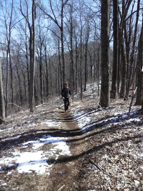
In normal fashion, we were the last to leave the campsite in the morning. The first 3 miles of the day were tough and we went slow. In parts of the trail the snow had been compacted to ice, and we had to watch each step. In some places there were drifts over a foot high. This is all on the slope of the mountain, mind you, and the downhills were worse than going uphill. We witnessed 3 people quit today, just fed up with it and the weather. We have also seen hikers with 3-foot long machetes, fishing poles, and camp chairs. Crazy. We went up and over Standing Indian Mountain in the afternoon, and made our way to Beech Gap for the night. There were about 10 thrus camping here as well.

3/29 Good Friday
We both slept well and got up, had breakfast, and were not the last to hit the trail for the day. We had an easy 10 miles before we got to Albert Mountain, which was a hard climb. There was also no wind, a nice change. In the morning, we walked over what was once mud, but now is frozen concrete with the impressions of the boots of hikers in front of us. We leave no footprints of our own this morning. The trail alternates between this frozen mud on which you have good traction, and layers of compacted snow turned to ice, on which you have no traction. We pass through rhododendron thickets, which provide cover and allow the snow to linger. All in all, the nice weather this morning overcame any issues with the trail.
We reached Albert Mountain and knew what we were in for, because we remembered it well from our 2005 hike. The trail goes straight to the top following the ridgeline, but it is short. It emerges at the base of a fire tower. We took it slow but I remember it being worse than it was. It was snowing at the top. Downhill after that we passed the next shelter, got water, and made it to Glassmine Gap for the night. We are by ourselves. We found a small tentsite in the thicket large enough for our tarps. We are on a ridgeline not more than 30 feet wide, in between two peaks. There is not much flat ground here. We tried to get to a lower elevation, but are still at 4200'. We are both warm and dry and plan on making it to NOC on Monday, where we can get food and a shower. Three days after that we will be at Fontana Dam, the southern entrance to the Smokies.

Also, we passed 100 miles today. We are now at 103.3 mi.

Tuesday, March 26, 2013

Georgia Snow

The rain started about 3AM Saturday morning. It was light and we were sheltered from the wind, so had a comfortable sleep. We packed up in a break of the rain, but we were surrounded by mist and fog as if camping in a cloud. Everything was getting gradually wet. The rain stopped by noon, and we continued our day's walk in the fog. The afternoon turned into a nice walk. Most of the thru's we met were going to Low Gap shelter from Neel's Gap, but we just stopped there for water and kept going along easy logging roads for another 4 miles to Cold Springs Gap where we camped for the night. 12.5 mi for the day.

I thought we had a good spot at Cold Springs Gap, but soon after dark the wind picked up and it rained off and on all night. Everything was damp and again it was like being in a cloud. Even though we had tarps suspended over our hammocks, the wind blew the rain and mist horizontally, getting everything underneath wet. My hiking clothes blew down from the clothesline overhead and I collected them and put them under my knees to warm up inside my hammock and hopefully dry out. I started to get worried about our sleeping bags, as their outsides were getting progressively wetter from the blowing mist. At one point I wrapped my rain poncho over one end of the hammock in a futile attempt to protect it from the dampness. We both faced similar conditions but at least slept warm despite it all.

In the morning we found ourselves out of water and decided to go to Blue Mountain shelter before having breakfast. We packed up, leaving our sleeping bags until the last to allow them to dry if possible. We started the morning cold and wet, and walked 3 miles before finding water. The shelter was a little further, but offered no real protection from the constant wind. Starving, we ate breakfast there anyway. This day contained our first series of 1000 ft ups and downs. After breakfast we had a 1000 ft down, up, down, and up. We stopped at the Cheese Factory site for the day in favor of its lower elevation and set up camp over the crest of the ridge to escape the wind. We angled our tarps sharply downward to protect our hammocks from any wind. Our gear and clothes were spread out in an attempt to get them to dry. Our sleeping bags were surprisingly dry when we unpacked them and we both got to bed early to get warm and off our feet. Again, I slept with my hiking clothes under my knees to keep them warm and get them to dry out. 9.5 mi for the day.

There was occasional rain overnight, and at dawn it began to snow. Our water bottles were frozen, and the rain soaked hammock straps were frozen to the trees. Having dry clothes made breaking camp more pleasant even though the wind had picked up. As we were breaking camp, Georgia Bulldog walked by on his way to get water. We had met him the first day on Springer and had been leap frogging each other since then. Bulldog had camped on the top of the ridge and complained of his frozen tent that morning. He was ready to go and we started the trail not far behind him. We had Tray Mountain to get over first thing, and we basically tried to eat some breakfast bars as we walked because it was too cold to stop in the wind. Kelly Knob was another good climb later in the day. We walked through blowing snow and wind, but we agreed that it was more pleasant than yesterday's rain. Our original plan was to camp close to Dick's Creek Gap and hitch into Hiawasee in the morning for a zero day and resupply. As the day wore on, however, the constant wind took its toll and we decided to try to get into town that night. A long downhill led us to the road crossing, and after not more than 15 minutes we had a ride. Bulldog had arrived with us to the road, and we found room for all three of us and our packs. The first two motel choices were full, so we had to go to the Holiday Inn Express. We shared a room with Bulldog and were relieved to get out of the wind. We ordered pizza and didn't leave the room for the night. 13 mi for the day.

Unfortunately we turned the heat up too high, and in the middle of the night it was way too dry in the room and my sinuses were complaining. We were all having trouble sleeping. Hearing voices outside, Bulldog left the room and came back with Wrong Way and Hammy, two other thrus we had met on the trail. It was Wrong Way's 21st birthday and they were both still celebrating. Now the party was in our room. We turned the heat down and after visiting for an hour I actually felt better. Our company left and we went back to sleep.

Tuesday was spent doing laundry, unpacking our food resupply box from home, and buying a few things from the grocery. And eating. Food. Any food. We went to an all you can eat for dinner, and have a shuttle arranged for 9AM Wednesday morning to take us back to the trail. The weather is supposed to clear up and hopefully the rest of the week will be nice.

We are at mile 69.6, Hiawasee GA
Our goal for this next stage is to get to Fontana Dam, entrance to the Smokies. It should take about 8 days.

Pic of Hammy, Wrong Way, Bulldog, and Packrat.

Friday, March 22, 2013

A Day In The Life

Here is a recap of the last two days:

Gooch Mountain Shelter turned out to  be a horrible place to camp. The wind was ferocious all night long and we got little sleep. During the night I got up three times to fix the stakes for the tarp. One of those times the wind must have blown a stake into my hammock without my knowledge. The next time that I got up I heard a ripping sound, and discovered that the stake had ripped a hole in my hammock. I managed to sleep in it the rest of the night without further damage, but knew that it had to get repaired somehow before I used it again. There was a needle and thread in my ditty bag, and I hoped it could be fixed with what I had.

So it was a great start to Thursday morning. The wind tortured us in gusts as we tried to pack up that morning. We even walked a mile or so before eating breakfast just to get out of the wind. The rest of the day was going well and we saw many other thru-hikers on the trail. At one point there was a group of us at an overlook. I took my camera out of my pocket and fumbled it, dropping it onto rocks. The shutter button broke off, but luckily nothing else was broken. It was still a bummer. Now I have to keep track of this tiny piece of plastic to take a picture. Hopefully it can be taped on or something.

The goal of the day for most of us was to get to Lance Creek and camp there, about a nine mile day for us. The six miles before Neel's Gap requires the use of a bear cannister to camp, and so the idea was to stop just before that restricted area to get us in position to reach Neel's the next day. There were many thru's there, so we just got water and continued on down the trail. We went another mile or so and again were trying to find escape from the wind. We came to a gap were there was an obvious side trail and some flatter ground. We had been walking on the side of a mountain where it would have been difficult even for a hammock. So we decided to stop and went downhill below the trail to escape the wind and set up camp. I noticed that the side trail led to a house but didn't get too close. Our camp was on the opposite side of the gap from the house, and we were on the side of a hill. We found a little bench to cook on and a small spring was nearby just for us. I sat down and set about repairing my hammock with needle and thread. It took about twenty minutes but I was happy with the result and think that it should hold until Maine. While fixing supper our soup got knocked over off the stove, spilling half of it. So it had been kind of a messed up day all around. We were sitting in our hammocks just before dusk, enjoying our private campsite in the middle of nowhere with its own spring and views of the mountains when we heard footsteps coming to our camp. We were startled temporarily and wondered if we had done something wrong. As it turns out it was the lady that lived in the house that I had noticed. She had come down to invite us for breakfast in the morning. Our first trail magic! My day instantly got better.

Friday morning, after sleeping much better than the night before, we broke camp and headed over to the house for breakfast. We had our fill of good food and coffee, along with 12-15 other thru's that came through in stages. We thanked our host and hit the trail feeling full and good. We had Blood Mountain to climb for the day before reaching Neel's Gap. It was our biggest and longest climb so far. We took it easy and made it up and over sooner than expected. We arrived at Neel's Gap and set about getting a shower, doing laundry, and getting food. It was a great disappointment to find Neel's out of hot dogs, I had seen pictures and had been craving one for three days. Oh well. We were in and out in two hours even though there were many hikers there. Special thanks to Baltimore Jack and crew for their assistance.

Many thru's were spending the night in the hostel or nearby cabins, partly due to fear of upcoming rain. It is supposed to rain tonight and all weekend. Joy. We continued on, not in any particular hurry and enjoying the walk. We passed thru hiker "Bamboo" at Bull gap and continued on three miles past Neel's to Swain Gap. There is a nearby spring and we have an excellent camp for the night all to ourselves. It seems like we are all alone on the trail right now.

In conclusion, we are at mile 34, a nice camp where we have eaten supper and layed down at dusk. I have spent about two hours typing this on a micro keyboard, so I hope you, dear reader, can appreciate that. We are warm, clean and dry, but lay here in our hammocks anticipating the upcoming rain. Our plan is to reach Hiawasee early Tuesday morning. Stay tuned.

Wednesday, March 20, 2013

Day 3

We are stopped for the night at Gooch Mountain shelter, mile 15. It is windy and cold now and I am snug and warm in my hammock. We plan to be at Neel's Gap on Friday. Mornings have been cold but good hiking weather. We are taking our time and feel good.

Springer

After walking for a day we reached the start of the trail. The AT officially starts at the top of Springer Mt, which we reached this morning. We are camped for the night at Hawk Mt shelter 8.1 miles in from Springer.  After the storm last night today was a perfect day to walk in the mountains.

Beginning

We left home Sunday and spent the night at a friend's home in Tennessee.  From there it was a three hour drive to Amicalola Falls State Park on Monday.  I was nervous the whole way. We arrived, checked in, and started the trail by 1 PM. We were #502 and 503. Wander's pack was 28 lbs.  Mine was 32 lbs.
As I type this we are camped by Black Gap shelter, 7.3 miles in.  It is pouring rain and we are stuck in our hammocks.  Thunder, hail, rain, and wind have been today's theme.

Sunday, March 17, 2013

In Transit


It's time to go! We are on our way to Springer, and are spending the night at a friends house in Tennessee. Tomorrow we start the trail.

Saturday, March 16, 2013

The Beast

The Beast


I think I have all of the sewing finally done as of today, Saturday, one day before we leave home for the trail. After sewing two hammocks, two tarps, two backpacks, two vests, two wind jackets, two wind pants, various stow bags and pack liners, and one mosquito head net, I will say without hesitation that sewing is not something that I will be missing while on the trail.  Time for the sewing machine to get put away.  Next: a six month gear test.

Friday, March 15, 2013

The First Maildrop

Our first maildrop containing food is in the mail on its way to Hiawasee GA, where we will meet it at the Budget Inn.  All of the boxes have now been packed, taped shut, and mailing labels applied.
There is now a schedule page which is our best guess starting out as to our timing.  Undoubtedly this will change.  We have 19 maildrop packages containing various foods being sent to us during the next six months.  To coordinate timing with our support team back home we will be posting the next few upcoming maildrops in a post such as this:

Upcoming maildrops:

(Box #2 Send by 3/25)
Mark Deebel / Kristie Collins
C/O The Hike Inn
3204 Fontana Rd
Fontana Dam NC 28733
Please hold for AT Hiker
ETA: 4/4/2013

(Box #3 Send by 4/4)
Mark Deebel / Kristie Collins
C/O Bluff Mountain Outfitters
PO Box 114
Hot Springs NC 28743
Please hold for AT Hiker
ETA: 4/14/2013
------------------------------------------------------------------------------------------------------

We are leaving in two days and everyone expects us to be nervous.  Strangely, I am not and neither is Wander.  We were nervous maybe two or three months ago, off and on, but now, not so much.  The months spent of sewing gear (and even some clothing), dehydrating food, packaging food, organizing maildrops, packing, unpacking, and weighing gear are now almost over. The last minute frantic rush to get things done is going well, and a strange calm has entered our lives.  In a way this was the first part of the journey, and it is coming to an end.  We are quickly approaching phase II: the walking part.

This was also my last day of work after seven years at the same company.  I should say half day, I guess, since I didn't plan on coming back after lunch. My coworkers gave me a cool walking stick which had been passed around for everyone to sign, but I am afraid to take it with us because it will get seriously abused.  It would also get lost within the first week. Much appreciated and a great surprise, however. I spent the second half of the day running around town taking care of last minute business. 

Our gear list page has been added for those interested.  Both of our packs are very similar and we have a base pack weight of around 17 pounds. That is without food or water.  When we have a normal 4-5 days worth of food with us, we will be carrying around 25 pounds. (I think, we will see at the scale at Amicalola when we start.) These weights are also for winter gear, keep in mind, since we will be starting in March and would like to remain relatively warm.  Once we get to Pearisburg, Virginia, we will be switching to some lighter weight summer gear and clothes, and our packs will be correspondingly lighter.

One more day at home and then we leave for six months!

Wednesday, March 6, 2013

Snow

Home the day after.

The day after a snow storm.  There are several feet of snow in the Smokies and hikers are backed up at Fontana Dam waiting to go through.  The Appalachian Trail Kickoff is in 2 days, after which another wave of hikers will be starting their journey north.  Hopefully the snow will melt and they will get through.  We have 12 days to go before we start walking behind them.

More food.

Our food boxes are mostly packed, and after a trip to Sams Club they are completely full.  We are both ready to go and tired of the waiting game.

For those snowed in, here is some information about the trail courtesy of the Appalachian Trail Conservancy:

---------------------------------------------------------------------------------

The Appalachian Trail is one of the longest continuously marked footpath in the world, measuring roughly 2,180 miles in length. The Trail goes through fourteen states along the crests and valleys of the Appalachian mountain range from the southern terminus at Springer Mountain, Georgia, to the Trail’s northern terminus at Katahdin, Maine.

Known as the “A.T.,” it has been estimated that 2-3 million people visit the Trail every year and about 1,800–2,000 people attempt to “thru-hike” the Trail. People from across the globe are drawn to the A.T. for a variety of reasons: to reconnect with nature, to escape the stress of city life, to meet new people or deepen old friendships, or to experience a simpler life.

The A.T. was completed in 1937 and is a unit of the National Park System. The A.T. is managed under a unique partnership between the public and private sectors that includes, among others, the National Park Service (NPS), the USDA Forest Service (USFS), an array of state agencies, the Appalachian Trail Conservancy, and 31 local Trail-maintaining clubs.

Fun Facts

  • The Trail is roughly 2,180 miles long, passing through 14 states.
  • Thousands of volunteers contribute roughly 220,000 hours to the A.T. every year.
  • More than 250 three-sided shelters exist along the Trail.
  • Virginia is home to the most miles of the Trail (about 550), while West Virginia is home to the least (about 4).
  • Maryland and West Virginia are the easiest states to hike; New Hampshire and Maine are the hardest.
  • The total elevation gain of hiking the entire A.T. is equivalent to climbing Mt. Everest 16 times.
  • The A.T. is home to an impressive diversity of plants and animals. Some animals you may see include black bears, moose, porcupines, snakes, woodpeckers, and salamanders. Some plants you may encounter include jack-in-the-pulpit, skunk cabbage, and flame azalea.

Hikers

  • About 2 to 3 million visitors walk a portion of the A.T. each year.
  • The A.T. has hundreds of access points and is within a few hours drive of millions of Americans, making it a popular destination for day-hikers.
  • “Thru-hikers” walk the entire Trail in a continuous journey. “Section-hikers” piece the entire Trail together over years. “Flip-floppers” thru-hike the entire Trail in discontinuous sections to avoid crowds, extremes in weather, or start on easier terrain.
  • 1 in 4 who attempt a thru-hike successfully completes the journey
  • Most thru-hikers walk north, starting in Georgia in spring and finishing in Maine in fall, taking an average of 6 months.
  • Foods high in calories and low in water weight, such as Snickers bars and Ramen Noodles, are popular with backpackers, who can burn up to 6,000 calories a day.
  • Hikers usually adopt “trail names” while hiking the Trail. They are often descriptive or humorous. Examples are “Eternal Optimist,” “Thunder Chicken,” and “Crumb-snatcher".