Appalachian Trail

The Appalachian Trail is a 2185.9 mile long footpath stretching from Springer Mountain, Georgia to Mount Katahdin, Maine. Every Spring, hikers from all over head to Georgia and start walking north, attempting to hike the whole trail in one season. This is called a thru-hike. Only about 25% make it all of the way.

This blog follows our progress as we hike north.

Tuesday, October 8, 2013

Homeward Bound

   Where is home, anyway? Have I mentioned that? I can't remember. It's Bedford, Indiana, located in the south-central part of the state. Yea, we're Hoosiers.
   Rolling hills and cornfields. Limestone and caves. In fact, Bedford calls itself the 'Limestone Capital of the World'. A thick, dense layer known as Salem Limestone can be found here in better quality than anywhere else in the U.S. It has been used in such places as the Empire State Building and the Pentagon. But I digress...
   Just how were we planning on getting home from Maine? Well, for one, we never really had a plan since we didn't expect to make it this far in the first place. We'll cross that bridge when we get to it, we would say, rolling our eyes. Well, here we are.
   Several friends and/or family had offered to come and get us, but when push came to shove the practicality of that fell through. They seemed to be much more concerned about how we were getting home than we were. From our perspective, after walking here almost 2200 miles all the way from Georgia, we figured we could find a way.
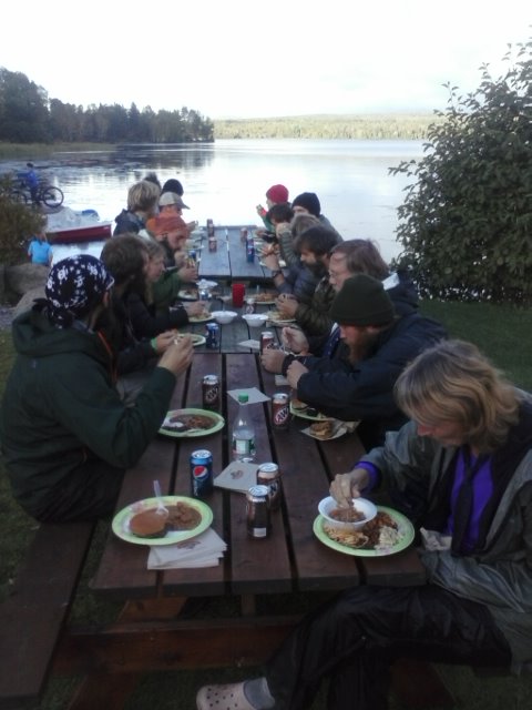
   As I said in an earlier post, we left Baxter State Park on 10/5 in a shuttle headed for Millinocket, the closest town. All thru-hikers pass through here when they are done. The local hostel, the AT Lodge, was full for the night, so we got a room at a motel, found some Chinese food, and went to sleep. The following day was Wander's birthday, and we planned to spend the day in town before heading home the next day. One final zero day. We needed to find some clothes that didn't stink, say goodbye to our AT friends one last time, and get some rest before our long (well, relatively) journey home. We got a room at the AT Lodge that night and had a good time staying immersed in the AT culture for just a little bit longer.
   The following morning the Lodge drove us a short distance to Medway, where we caught a bus to Portland. Long, long ago we had promised ourselves a lobster dinner in Maine, and this was our chance to make that happen. We spent the night in Portland and explored a little bit of the waterfront, bought some souvenirs, and ate our Lobsters.
   We had decided to try traveling home by train, and so the next morning we caught one headed for Boston out of Portland. Once in Boston we had to take a subway to a different train station where we got on a train headed for Chicago. We will get off early in Elkhart, IN, where Wander's brother lives and can take us home from there. All in all, about 24 hours onboard a train, which is where we are now. Somewhere in the middle of New York State, in the middle of the night, we creep along, inching our way closer to home.

Katahdin

   On Friday, 10/4, we only had 10 miles to go to reach Katahdin Stream Campground where we would spend the night and stage before the big climb the next day. Because of this we slept in and took a shower in the morning, and took our time hitting the trail. This also gave us an opportunity to eat more food. Several thru-hiking friends showed up at Abol that morning, and we were glad to see them, perhaps for the last time. For the past couple of weeks we had been running into people that we had not seen since the South, and our hike seemed to be coming full circle at the end.
   The 10 miles to Katahdin Stream Campground turned out to be probably the easiest on the entire trail, and it was a relief to be given a break for once. We were in Baxter State Park now, the location of our final mountain. We knew the next day, when we planned to summit Katahdin, would be hard and we were both nervous about it.
   We checked in at the Ranger Station and then headed to the campground. The Ranger told us not to head up the mountain before 2 am...ok, no problem. Unfortunately the next day was Saturday, and the road that we were camped next to was amazingly busy with traffic heading into the park all night long. So it was a restless sleep that night for us, partly due to the traffic and partly due to our nerves and pure excitement about our last day, last mountain, last climb.
   Saturday, 10/5, was another beautiful day, and the rain that had been called for never materialized. In fact, we had made it through the entire 100-mile Wilderness without a drop of rain, something we did not expect to happen. I couldn't remember the last time that it did rain, actually, sometime back at Rangeley, perhaps?
   We hit the trail slightly before 8 am, and had 5 miles to go to the top of Katahdin. There were already over 100 people ahead of us, mostly day hikers, and the trail was packed. This was the biggest single climb on the entire trail, and from the campground we had an elevation gain of 4200 ft to the top. The first mile was easy, but the next two really started the climb. After that we reached treeline, and the final two miles were spent scrambling and boulder hopping up the side of the mountain. For our New Mexico readers, imagine Cabezon. Times four. It took us 4 hours to reach the top, which we did some time around Noon. The top was loaded with people and we had to wait in line to take our summits photos.
   After six and a half months and nearly 2200 miles, our hike was finally done. Well, except for the fact that we had to get back down off the mountain. That required turning around and retracing our steps for the last 5 miles. So, after about 30 minutes on top we turned around and headed back down the mountain. It was the first time in this entire adventure that we walked southbound on the trail, and it felt strange.
  The journey down the mountain turned out to be more difficult than the journey up, in some ways, and was definitely hard on the knees. Large blocks of granite that we had climbed up now created some scary drop offs on the way down. You did not want to trip. We made it back to the bottom and the Ranger station around 5 pm, signed out, and caught a shuttle out of the park. We were done. The whole thing went too fast.
   Now we just had to get home.

Livin' For The City

   And by city I really mean town, and by town I really mean the Abol Bridge campstore and restaurant, an oasis at the end of the 100-mile Wilderness. You see, when we left Monson on Friday, 9/27, we thought we had enough food to last us 8 days. That was how long we planned to take to traverse the 100 miles. Three days into the Wilderness, however, we realized that was not the case, and knew we didn't have enough. We had been starving ourselves, trying to ration our food, and felt like crap as a result. So on that third day we finally said 'screw it' and ate a large dinner that night. That put us in a position of needing to do the 100 miles in 7 days, and having no choice, that is what we did.
   The first 40 miles were tough, requiring us to go over Barren Mtn, Fourth Mtn, Third Mtn, Columbus Mtn, and Chairback Mtns in one hard stretch. That was followed the next day by Gulf Hagas Mtn, West Peak, Hay Mtn, and finally White Cap Mtn in another stretch. From the top of White Cap we got our first view of Katahdin in the distance, the goal we had been working over 6 months to reach. After White Cap the remaining 60 miles were relatively flat, but, being Maine, they were still tough. Rocks, roots, and mud were our constant companions. Every step, it seemed, had to be as difficult as possible.
   When I was not bitching at the trail in my head I was dreaming about food, any type of food, really, other than the standard backpacking fare we had been living on for 6 months. Specifically, I became obsessed with reaching Abol Bridge where there was a camp store and real food. And rumors of beer as well.
   As tough as Maine was it was also beautiful, as I have said before, and the Fall colors were at their peak. The temperature was perfect, there were no bugs, and, in short, it was perfect hiking weather and a perfect time to be in Maine. So there was that.
   The trail also passes many lakes along this stretch. Not just lakes, but perfect lakes with beaches and clean shorelines and crystal clear water. Some of them were huge. You could literally go swimming every day if you wanted to. Being the end of September, however, it was a little too cold for that. At least for us, anyhow.
   What we did not get to avoid, however, were the river fords. Sometimes there were three a day, across ice-cold knee-deep rushing water. Sporting, to be sure.
   We finally reached the end of the Wilderness and Abol Bridge on Thursday, 10/3. Our foodbags were empty. We got a campsite with a view of Katahdin and stuffed our faces with food from the store. It was wonderful.

Thursday, September 26, 2013

Part III: Fall

Stratton - Caratunk - Monson

We have made it to Monson, Maine. The last trail town in the North. Finally. Tomorrow we start the 100-mile wilderness, the last stretch to the end.

Mile 2074.4
114.5 miles left to go.

Thursday, September 19, 2013

The Endgame

Horns Pond Lean-Tos
Mile 2002.8
183.1 miles left

Today we escaped the town of Stratton, Maine. Towns are like blackholes and suck you in...and are always difficult to leave. This morning we awoke in our room at the Stratton Motel after a restless night's sleep for the both of us. The bed sucked, basically. Now I have a kink in my neck. But we have been in worse places and such is life on the trail. The owner gave us a ride to the diner down the road where we had breakfast. From there we hitched the further 4 miles to the trailhead.

We have 183 miles left to go and every day is a struggle. It didn't seem possible that anything could be harder than the White Mountains of NH, but Maine is up to the challenge of being the toughest state. It is also the most beautiful.

I should backtrack a little bit and explain how we got to Maine in the first place:
    After reaching Glencliff NH on 8/23, we reached the White Mountains, a noted difficult and yet very beautiful section. On 9/5, after 80 brutal miles and a series of delays, we emerged at Pinkham Notch, Gorham NH. We had just gone over the Presidential Range where Wander had twisted her ankle on the way down. She also had a knee that was badly bruised. She said it was the hardest thing she has ever done. We had 75 mph wind gusts as we hiked along, for example. It gets to you. So, we were both in shock from the 4 day traverse of that mountain range, 15 miles of it above treeline with Mt. Washington in the middle. Our spirits were down because we had been hobbled by the Whites and were creeping along, and now suddenly we were worried about having time to finish. While October 15th is the hard deadline when the mountain basically closes, we were shooting for October 6th, Wander's birthday. With still over 300 miles to go it seemed nearly impossible. We gave her ankle a day, and then the next we tried to get back on the trail. It was not to be, however, and we returned to town.
    After a few more days of rest, filled with uncertainty and self doubt, we knew we had to either get back on the trail or go home. By sheer luck Miss Janet happened to be in town, and gave us a shuttle ahead to Andover, Maine on 9/9. Unfortunately this meant that we would skip over the NH/ME state line as well as Mahoosic Notch, two things that I was looking forward to seeing. So yes, after walking a solid 1866 miles, we skipped ahead about 70. This put us within 250 miles of the end, a distance we felt we had enough time to cover. We would find out it was like jumping from the frying pan into the fire.

Back to today: So now it is 9/19, and we have been walking through Maine for 10 days now, having our butts kicked every single one of those days. We are still trying to take it easy on Wander's ankle, but have had some seriously tough mountains to go over as well. We are now staged to go across the Bigelow Mountains tomorrow, since we did the hardest part of the climb today. After that, the elevation profile sort of calms down a little, and things don't look so bad up ahead. It looks like we have 4 days to Caratunk, then 4 days to Monson, then the 100-mile wilderness and we are at Katahdin. Piece of cake, right?

For the first time on the trail we have been thinking about the future, discussing how to get home once we are finished, what we want to do when we get there, and basically dreaming of not having to walk all day, everyday, anymore. We are both homesick I will admit, and a part of us is just ready to be done. Sad but true. We are both just too stubborn to quit.

However, Maine, for as tough as it is, is also beautiful. We remind ourselves of this, and that we may never be here again, and that it is OK to slow down. Fall is my favorite time of year, and it is here upon us. The leaves are changing colors, and we have had several frosts up in the mountains. Soon, it is going to get cold.

Tomorrow, we need to walk at least 10 miles toward a mountain that we have still never seen. And the day after that, and the day after that. For 17 more days.

PS - Yesterday was our 6-month anniversary of starting the trail. Today we passed mile 2000.

PPS - The beard says hello and would like to thank its admirers. You know who you are.

Bigelow Mountains

Out of Stratton to Horn's Pond Lean-Tos

Southern Maine 2

Rangeley to Stratton
Saddleback Mtn and Horn and Jr
Lone, Spaulding, and Sugarloaf Mtns
North and South Crocker Mtns

Southern Maine 1

Andover to Rangeley Trail Fest Gray Beast Hiker Hostel